The Sainte Victoire winemakers cooperative have created a walking path you will not want to miss. The Winemaker’s Trail (le sentier des vignerons) will lead you through vineyards with several different grape varieties.
The path is not extraordinarily long but sturdy. As you circle the base of the mountain Sainte Victoire, you will learn about the area’s modern and ancient heritage, both natural and cultural.
The abundant springs in this area allowed men to settle at the foot of one of the most famous mountains in the world. During the hike, you’ll cross terrain that will show you see much wild and natural beauty, although the land has been worked on for thousands of years.
The Cooperative Winemaker’s Trail will help you understand the winemakers’ grape variety choice for this type of land and the work done during the different seasons.
The village of Puyloubier is located at 350 meters above sea level and the soothing view of the Upper Arc Valley is breathtaking. This was one of the reasons the Foreign Legion created a home for their wounded soliders at the Château du Général.
Coming out the winemaker cooperative center take the stairs to the right at the information sign in front of the building. Walk around the cooperative and take the Chemin des Vertus (you see the Village Hall at your left).
After 150 m, take the dirt path on the right. This path leads along a vineyard. On your left is a small house with a Cypress tree.
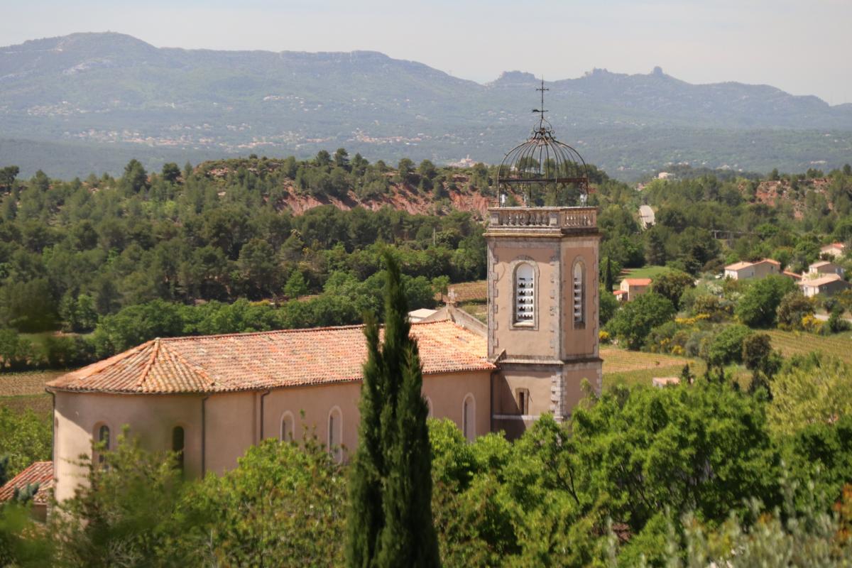
This is the neighborhood l’Avocat and the path goes down towards the l’Oratoire St. Roch. From here the views of part of the village and the mountain Sainte Victoire behind it are very beautiful. From the Oratoire, follow the path on the right. You’ll find yellow markings on the bridge.
Continue to the edge of the wooded area. Here you’ll find the first grape variety marking A, Cinsault. These markings on small wooden posts with the letter indicated on the top.
Turn left at the edge of the wooded area and follow this path surrounded with oak, maple and elm trees. The path will lead to the D12 road. Take this road to the left and continue about 300 m. Be careful, this road does not have a shoulder.
Take a right at the dirt road with the black/yellow poles and continue for about 200 meters. Here you’ll see a marker on the left to show you the direction to take. Follow the main path that zigzags between the Defens vineyards. Here are the views of the Sainte Victoire in the West and the Domaine St. Pons in the east breathtaking.
The path will turn slightly to the left until you arrive at the
Continue straight towards the village. Pass the wastewater treatment center and garbage dump onto the D57D. Turn right on the olive
The road makes a curve to the northeast. A little further you’ll see the marking C, for the Carignan wine variety, on the side of the road. Follow the path until you see marking D, for the Vermentino (or also called Rolle) wine variety, just before you climb onto the road. Take the road to the right until the oratory of the Château du Général of the Foreign Legion.
From the oratory the winemaker’s trail
To continue the trail, follow the long stone wall, leave the white house on your left, and continue straight into the scrubland. A little further a sign will direct you to the left (west). Cross the fields to the monument at the Foreign Legion entrance.
Pass the monument and take the D57 towards the village. Leave the entrance of the Clos Sainte Victoire at your right and continue straight. when you arrive at the playground, take the Chemin du Stade at your right.
Take the road that goes up the hill. Be sure to keep the stadium to your right. This path goes around the houses and back to the village center. Along this path, there will be nice views of the village, the Arc Valley and the surrounding mountains. Follow the signs for the Chemin de Vauvenargues. Then cross the Place Damasse Malet and the communal wash station of the village.
The winemaker’s trail ends at the Wine Cooperative at your left. Now its time for a tasting of their best rosé!
For more beautiful images of Puyloubier, see our slideshow below.